RustGIS Introduced as a Fast, Free and Open-Source Geographic Information System in Pure Rust
· GlobeWire Daily Tech Desk · Source: github.com
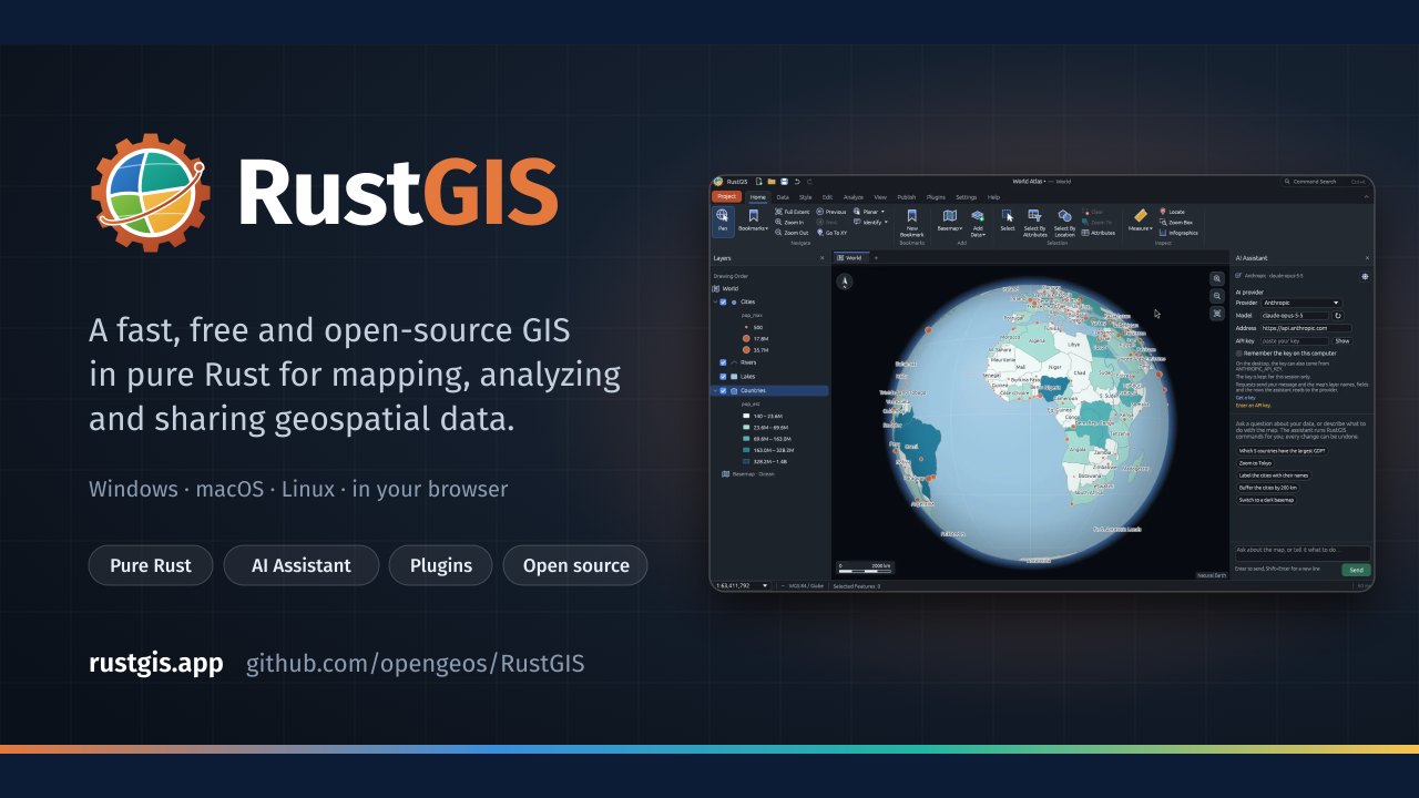
Image: GitHub · Photo source · Resized and letterboxed to 16:9; no AI generation
RustGIS is presented as a fast, free and open-source Geographic Information System (GIS) developed in pure Rust for mapping, analyzing, and sharing geospatial data. According to available project documentation, the software runs natively on Windows, macOS, and Linux, and is also accessible via a web browser through WebAssembly.
Key Features and Architecture
- Local Processing: Files are read and written directly on the user's machine without automatic background uploads.
- Command-Driven Interface: Every interface action corresponds to an identifiable command that can be scripted via the command line or integrated into notebooks.
- Tool Integration: The platform includes access to various geospatial and terrain analysis tools through integrations such as GeoLibre.
- Cross-Platform Availability: Native binaries and package manager installations are supported alongside a web-based version.
Practical Implications and Verification
Users interested in evaluating RustGIS can review the source code, installation instructions, and user guides directly on its official GitHub repository and associated web portals. As with any open-source software, practitioners should verify compatibility with their specific data formats, operating environments, and analysis workflows before deployment in production settings.
AI-assisted reporting; source claims are attributed and have not been independently verified.
More to read
 WordCraft: An Open-Source, Clean-Room Word Processor Built in Pure Rust
 TablePro: Free and Open Source Native Database Client for Developers
 Compositor: A Free, Open-Source Mac Image Editor Designed as a Photoshop Alternative
 PdfCraft Enters Alpha Stage as an Open-Source Rust PDF Reader and Editor
Trending on GlobeWire Daily
Selected from recent coverage and related topics; not live search rankings.
 Madhya Pradesh Government Plans Revenue Generation from 117-Year-Old Edward Villa in Mumbai Through Leasing
 iPhone 18 Pro Named TechRadar Product of the Year 2026
 Google Project Suncatcher Runs Gemma 4 AI on Orbiting Satellite and Receives First Response
 Gender Disparities in Eye Care Access Across India Examined
 Satellite Images Show Cyclone Arnab Weakening Over India As New System Brews
 Expanding Green and Blue Spaces Crucial for India's Economic and Public Health, Reports Indicate