GeoLibre: An Open-Source, Cloud-Native GIS Platform for Multi-Platform Geospatial Analysis
· GlobeWire Daily Tech Desk · Source: github.com
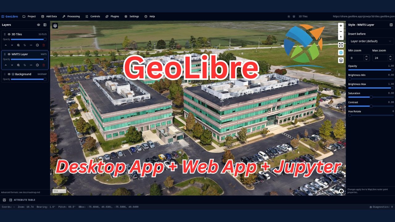
Image: GitHub · Photo source · Resized and letterboxed to 16:9; no AI generation
GeoLibre is a free, open-source, and lightweight cloud-native Geographic Information System (GIS) platform designed for visualizing, exploring, and analyzing geospatial data. According to project documentation, the platform operates across web browsers, desktop environments, mobile devices, and Jupyter notebooks while maintaining local data privacy.
Core Architecture and Rendering Engines
Built using Tauri v2, React, TypeScript, MapLibre GL JS, DuckDB-WASM Spatial, and deck.gl, GeoLibre allows a single project to be viewed through multiple rendering engines. Users can switch between MapLibre GL JS, Mapbox GL JS, CesiumJS, or the ArcGIS Maps SDK for JavaScript, or display them in synchronized split panes without duplicating project layers. The platform reads cloud-native formats such as COG, GeoParquet, PMTiles, FlatGeobuf, Zarr, and STAC in place.
Browser-Based Geoprocessing Tools
GeoLibre includes over 1,000 geoprocessing tools that execute entirely within the browser via a WebAssembly runtime. These tools cover various analytical domains:
- Terrain and hydrology analysis
- LiDAR and remote sensing
- Vector analysis
Executions occur locally on the user's machine without requiring a server setup or an external Python sidecar, though an optional self-hosted Python environment is available for certain tasks.
Multi-Body Planetary Mapping
Beyond Earth geography, GeoLibre supports planetary basemaps from OpenPlanetaryMap and USGS Astrogeology. Available bodies include:
- The Moon, Mars, Mercury, and Venus
- The Galilean moons (Io, Europa, Ganymede, Callisto)
- Titan, Pluto, and Charon
Each project applies a specific ellipsoid to ensure distance, area, and scale calculations match the mapped celestial body. Deep-space starfields and atmospheric effects are rendered using the Atmosphere Effects plugin.
Verification and Access
Users can verify project details, installation steps, and source repositories directly through the official GitHub repository (`opengeos/GeoLibre`) or documentation published at `geolibre.app`. Academic users can cite the platform using its Zenodo archive entry.
AI-assisted reporting; source claims are attributed and have not been independently verified.
More to read
 Diagram Design Open-Source Agent Skill Launches for Multi-Platform AI Coding Assistants
 Cindy Open-Source AI Agent Platform: Features, Multi-Device Capabilities and Licensing Overview
 OpenClaude: An Open-Source Multi-Provider Coding-Agent CLI
 Spotube Open Source Cross-Platform Music Streaming App Detailed in Repository Documentation
Trending on GlobeWire Daily
Selected from recent coverage and related topics; not live search rankings.
 Madhya Pradesh Government Plans Revenue Generation from 117-Year-Old Edward Villa in Mumbai Through Leasing
 iPhone 18 Pro Named TechRadar Product of the Year 2026
 Google Project Suncatcher Runs Gemma 4 AI on Orbiting Satellite and Receives First Response
 Gender Disparities in Eye Care Access Across India Examined
 Satellite Images Show Cyclone Arnab Weakening Over India As New System Brews
 Expanding Green and Blue Spaces Crucial for India's Economic and Public Health, Reports Indicate